


Stock # 155-SD652P
PLATINUM+ MARINE CHARTS (NAVIONICS)
In Stock
Call for Price


Overview
Specifications
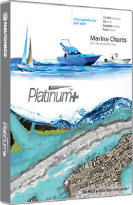
Head out with confidence! All the same marine content and advanced features found in Navionics+ are augmented by satellite imagery with SonarChart Shading, relief shading and sonar imagery chart overlays, 3D View and panoramic photos to provide the ultimate situational awareness. Designed with the most demanding boaters and serious anglers in mind, these additional viewing options can be used on a growing number of GPS plotters. Quickly target the best spots and catch more fish. Daily updates and advanced features are included for 1 year and provide you with Dock-to-dock Autorouting, SonarChart™ Live, Advanced Map Options and Plotter Sync. Simply plug your card into your computer and register at Navionics.com.
Sale Type
New
Manufacturer
Navionics
UPC
821245652591
Hazard
9
LNSuse1
4090873
LNSuse2
1512238
LNSuse3
20009
ModuleID
PF_429750
DMPPartNo
24-1716
KMSPartNo
NAV SD652P
AS400Description
LAKE HURON PLAT +
VendorItemNumber
SD652P
Sale Type
New
Manufacturer
Navionics
Quantity
1
UPC
821245652591
Hazard
9
LNSuse1
4090873
LNSuse2
1512238
LNSuse3
20009
Features
- 1 contours inshore and nearshore
- 3 and 6 contours offshore beyond 90
- Daily updates and advanced features for 1 year
- Preloaded with Nautical Chart and SonarChart™ chart layers; Community Edits are downloadable
- Enjoy advanced features such as Dock-to-dock Autorouting1, SonarChart™ Live, Advanced Map Options and Plotter Sync
- Enhance the SonarChart™ contour map with sonar logs you collect
- Includes tides and currents, safety depth contours, navaids, coastal points of interest and port services information
- Check Navionics.com/compatibility
Store Hours
Monday 8:30 AM - 5:30 PM
Tuesday 8:30 AM - 5:30 PM
Wednesday 8:30 AM - 5:30 PM
Thursday 8:30 AM - 5:30 PM
Friday 8:30 AM - 5:30 PM
Saturday 8:30 AM - 3:00 PM
Sunday Closed
COPYRIGHT© 2024 Rg Dick Plummer Ltd.
All Rights Reserved
All Rights Reserved